The River Thames forms a large part of the Spelthorne Borough boundary. Although this provides a pleasant environment to live and pursue leisure interests in, the downside is that the risk of flooding has always been with us. When the Saxons founded our communities, they selected areas of high ground which remained above the seasonal floods – these are still marked by the location of the parish churches. As the population of the area has grown, we have built more and more houses in areas liable to flood, at the same time reducing the capacity of the land to absorb water.
Floods have by no means been uncommon over the years, occurring at regular intervals throughout the 19th and 20th centuries. There was a particularly bad one in May 1908, and another in 1928. The building of the Desborough Cut in the 1930’s did much to alleviate flooding in the Shepperton and Halliford bends of the Thames, but in 1947 a truly exceptional flood inundated a huge area. That year saw a hard winter with a thick covering of snow, but in March a sudden thaw overwhelmed the local watercourses. In Shepperton, the Church Square area was entirely cut off from the High Street, and army vehicles were brought in to ferry people between the two. In the shattered post war economy, with rationing still in place, this flood caused particular hardship.
Since then, 1947 has remained the yardstick by which other floods are judged. In 2003 severe flooding again hit the Thames locally, and besides the expected flooding of the immediate riverside areas, Chertsey Bridge was cut off on the Spelthorne side by water flowing across the bend of the Thames from Laleham to Dumsey Meadow, Shepperton. Only this year, however, have floods come close to the 1947 levels. Chertsey Bridge has once again been closed, floodwaters have reached the bottom of Shepperton High Street, and riverside properties flooded from Staines to Sunbury.
Properties which have never flooded before, in many cases because they have been built since 1947, have flooded this time. People have been evacuated to the safety of rest centres set up at public buildings, or found refuge with friends or family. Time will tell what strategies can be adopted to minimise this terrible disruption to people’s lives in future years, but it is possible that former plans for another flood alleviation channel running between Laleham and Shepperton will be resurrected, assuming the money can be found of course.
The next meeting of the Sunbury and Shepperton Local History Society is on Tuesday 18th March 2014 at Halliford School, when Peter Maynard will be talking about the History of Littleton, commencing at 8pm. Admission £2 non-members.
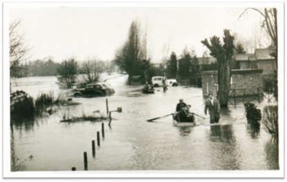
The floods of 1947 were the worst in living memory. This was the scene on the Towpath in Shepperton.
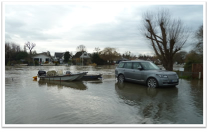
The Towpath at the same spot in January 2014. The car is parked in the same place. The houses behind are on Pharoah’s Islan.
Floods in the Lower Hampton Road, Sunbury, 1908
Flooded Rivermead Island, Sunbury, in January 2014
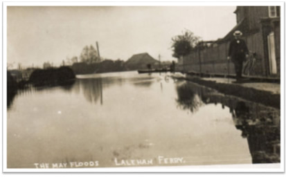
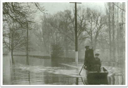
Floods at Ferry Lane, Laleham, May 1908
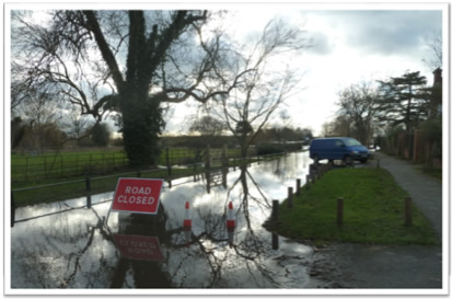
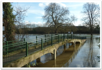
Almost the same spot – Ferry Lane, Laleham, January 2014